
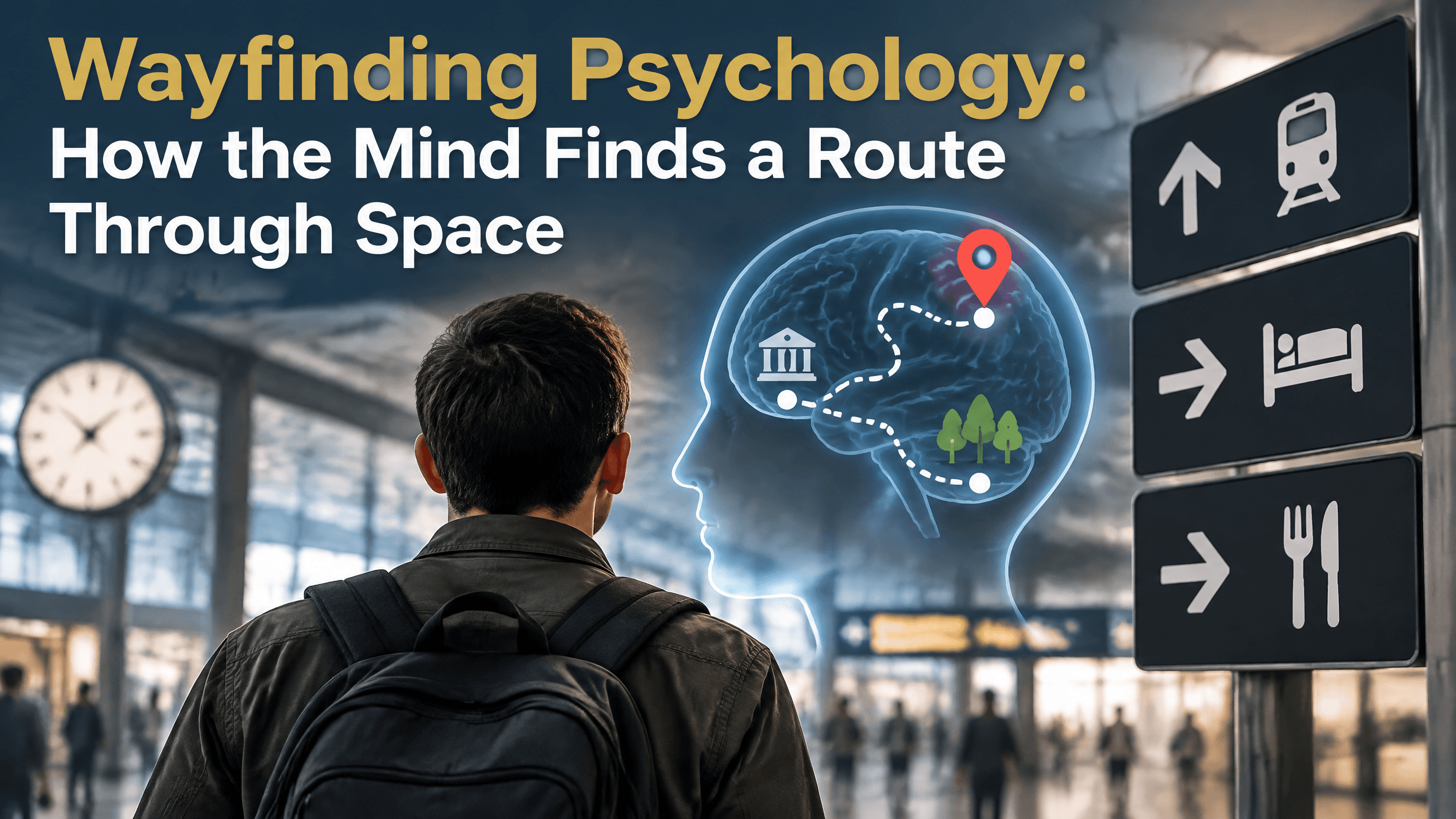
You leave a train station in an unfamiliar part of town. You know the name of the hotel, but not the exact route. First you work out which direction you are facing. Then you choose a street, look for a landmark mentioned in the directions, check whether the environment matches what you expected, and adjust if something feels wrong. Reaching the destination depends on more than remembering one turn.
This is the territory of wayfinding psychology. Wayfinding is the goal-directed process of moving from a current location toward a destination by using spatial knowledge, landmarks, route information, orientation, environmental cues, and ongoing error correction. It is broader than simply knowing a route and broader than simply knowing where you are.
The distinction matters because several spatial processes can contribute to wayfinding without being identical to it. A cognitive map concerns how an environment is represented. Spatial orientation concerns your current position and heading. Path integration concerns how movement itself updates location. Route knowledge stores a known path. Wayfinding brings these kinds of information together during the actual task of getting somewhere.
Quick Answer
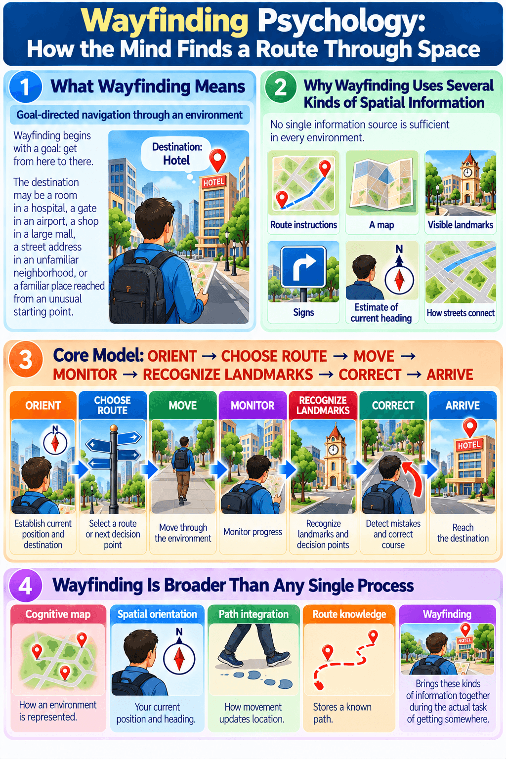
Wayfinding psychology examines how people reach destinations by orienting themselves, choosing routes, moving through an environment, recognizing landmarks and decision points, monitoring progress, detecting mistakes, and correcting course. It can use cognitive maps, route knowledge, signs, landmarks, spatial orientation, and movement-based updating, but no single one of those processes is the same as wayfinding itself.
What Wayfinding Means
Goal-directed navigation through an environment
Wayfinding begins with a goal: get from here to there. The destination may be a room in a hospital, a gate in an airport, a shop in a large mall, a street address in an unfamiliar neighborhood, or a familiar place reached from an unusual starting point.
A widely cited review of landmarks in wayfinding describes wayfinding as goal-directed movement toward a destination that cannot necessarily be directly sensed from the starting point. That framing captures why wayfinding requires representation and inference. If the destination were always visible straight ahead, far less spatial knowledge would be needed.
In real environments, the destination is often hidden by walls, streets, floors, buildings, turns, or distance. The traveler must therefore use indirect information to decide where to go next.
Why wayfinding uses several kinds of spatial information
No single information source is sufficient in every environment. A person may use remembered route instructions, a map, visible landmarks, signs, an estimate of current heading, or broader knowledge of how streets connect.
Human navigation research suggests that people can use several spatial strategies flexibly. A review of human spatial navigation across scales discusses egocentric, allocentric, and beacon-based forms of navigation, emphasizing that humans can use different representations depending on task and environment.
Wayfinding therefore works best as an activity-level concept. It describes what the traveler is trying to accomplish, not one single internal representation or mechanism.
Core Model: ORIENT → CHOOSE ROUTE → MOVE → MONITOR → RECOGNIZE LANDMARKS → CORRECT → ARRIVE
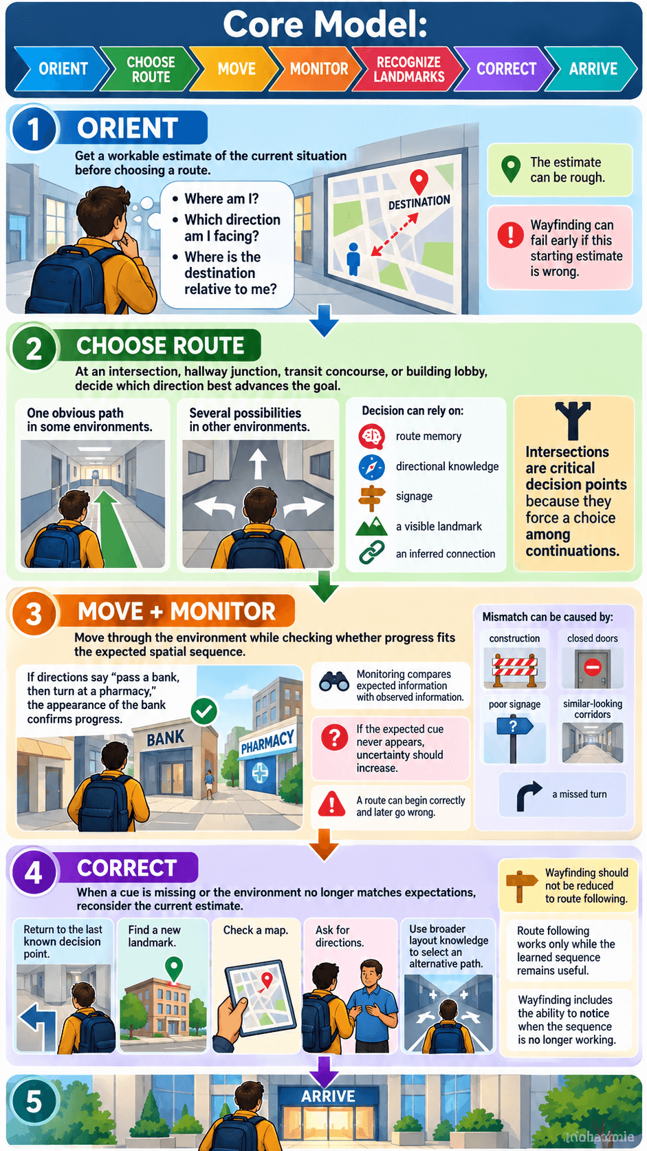
Establish current position and destination
Before choosing a useful route, the traveler needs at least a workable estimate of the current situation. That includes some combination of “Where am I?”, “Which direction am I facing?”, and “Where is the destination relative to me?”
The estimate can be rough. You may not know exact coordinates, but you might know that the hotel is toward the river, the river is downhill, and your current street runs roughly parallel to it. That may be enough to begin.
Wayfinding can fail early if this starting estimate is wrong. A perfectly remembered route is not helpful if it is applied from the wrong entrance or from the opposite side of a building.
Select a route or next decision point
Some environments offer one obvious path. Others present several possibilities. At an intersection, hallway junction, transit concourse, or building lobby, the traveler must decide which direction best advances the goal.
Research on spatial decision dynamics during wayfinding identifies intersections as critical decision points because they force a choice among possible continuations. This makes them psychologically important locations, not merely geometric features of an environment.
The decision can rely on route memory, directional knowledge, signage, a visible landmark, or an inferred connection. A person who knows the environment well may select a path almost automatically. Someone unfamiliar with the area may stop and compare several cues.
Move while monitoring progress
After choosing a route, wayfinding does not stop. The traveler must monitor whether movement continues to fit the expected spatial sequence.
If directions say “pass a bank, then turn at a pharmacy,” the appearance of the bank provides confirmation. If the bank never appears, uncertainty should increase. Monitoring compares expected information with observed information.
This comparison matters because a route can begin correctly and later go wrong. Construction, closed doors, poor signage, similar-looking corridors, or a missed turn can all create mismatch between expectation and reality.
Detect mismatch and correct course
Effective wayfinding includes recovery. When a cue is missing or the environment no longer matches the expected route, the traveler needs to reconsider the current estimate.
Correction might mean returning to the last known decision point, finding a new landmark, checking a map, asking for directions, or using broader layout knowledge to select an alternative path.
This is one reason wayfinding should not be reduced to route following. Route following can continue smoothly only while the learned sequence remains useful. Wayfinding includes the ability to notice when that sequence is no longer working.
Orientation Before Route Choice
Knowing where you are and which way you face
Imagine leaving an underground station through an unfamiliar exit. You know the destination lies east of the station, but you do not know which direction you are facing when you reach street level. The first task is not yet route choice. It is orientation.
Orientation creates a spatial starting point for wayfinding. A person who knows current location but not heading may still choose the wrong first turn. A person who knows heading but misidentifies the current exit may apply correct directional knowledge to the wrong place.
A useful distinction is between recovering a workable frame for the surrounding environment and locating yourself within that frame. Even in an ordinary building, you may first recognize which lobby or corridor system you are in, then work out which direction you face inside it.
Why orientation can matter even without a destination
You can be oriented without currently trying to go anywhere. Standing in a park, you may know that you are near the south entrance and facing west. That is a spatial state, not yet a journey.
Wayfinding begins when that orientation is used in service of a destination. “I am at the south entrance facing west” becomes “the museum is north, so I need to turn right and head toward the central path.”
This separation helps prevent the term wayfinding from swallowing every process involved in knowing where you are.
Route Choice and Decision Points
Intersections, turns, alternatives, and uncertainty
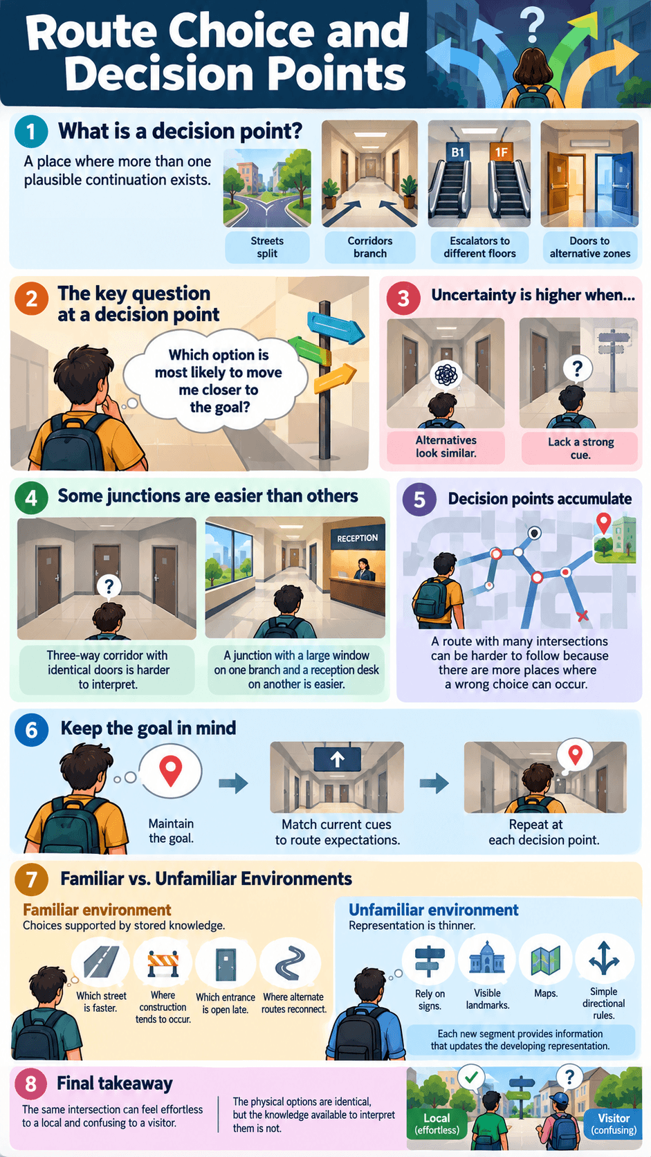
A decision point is a place where more than one plausible continuation exists. Streets split, corridors branch, escalators lead to different floors, and doors open into alternative zones. Each branching point creates a question: which option is most likely to move me closer to the goal?
Uncertainty rises when alternatives look similar or when the traveler lacks a strong cue. A three-way corridor with identical doors is harder to interpret than a junction where one branch is marked by a large window and another by a reception desk.
Decision points also accumulate. A route with many intersections can be harder to follow because there are more places where a wrong choice can occur. The traveler must maintain the goal while repeatedly matching current cues to route expectations.
How familiar and unfamiliar environments change the information available
In a familiar environment, many choices are supported by stored knowledge. You may know which street is usually faster, where construction tends to occur, which entrance is open late, and where several alternate routes reconnect.
In an unfamiliar environment, the representation is thinner. The traveler may depend more heavily on signs, visible landmarks, maps, or simple directional rules. Each new segment also provides information that can update the developing representation.
This difference explains why the same intersection can feel effortless to a local and confusing to a visitor. The physical options are identical, but the knowledge available to interpret them is not.
How Landmarks Support Wayfinding
Recognizing reference points and decision locations
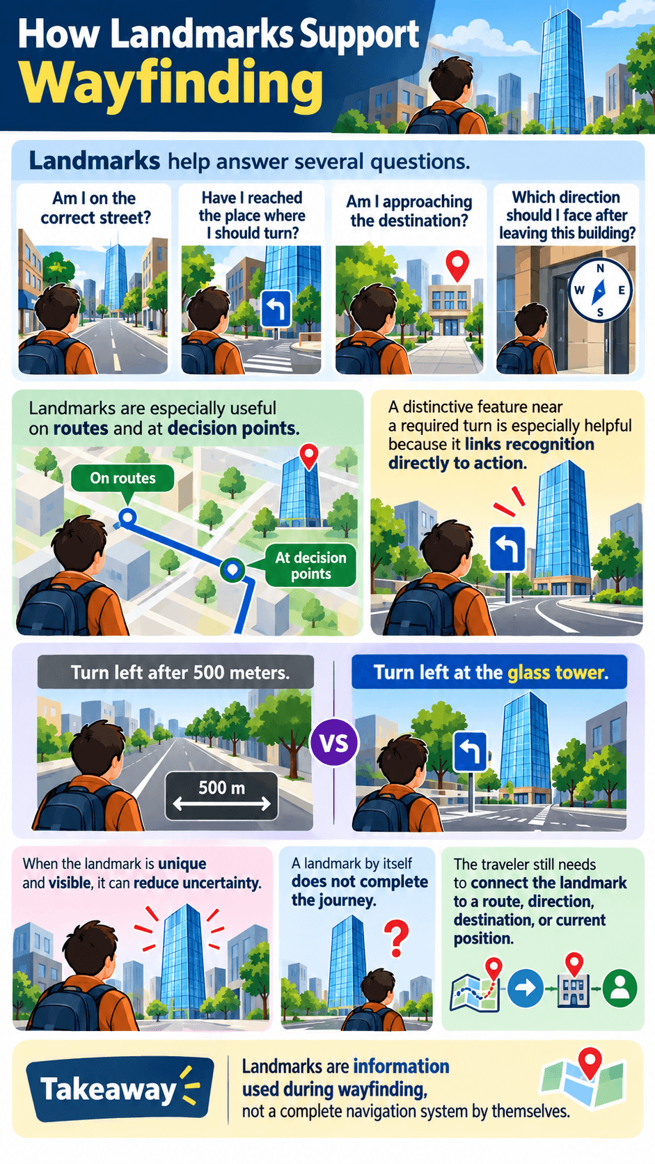
Landmarks help answer several different questions. “Am I on the correct street?” “Have I reached the place where I should turn?” “Am I approaching the destination?” “Which direction should I face after leaving this building?”
The usefulness of a landmark depends partly on where it appears. The landmark review cited earlier found strong support for the importance of landmarks located on routes and at decision points. A distinctive feature near a required turn can be especially helpful because it links recognition directly to action.
Consider the difference between “turn left after 500 meters” and “turn left at the glass tower.” The first instruction depends on distance estimation. The second ties the decision to an observable feature. When the landmark is unique and visible, it can reduce uncertainty.
Why landmarks are components of navigation, not a separate process
A landmark by itself does not tell a person how to complete a journey. The traveler still needs to connect the landmark to a route, direction, destination, or current position.
Seeing a church tower can help you orient, confirm a route, or identify a decision point. The same tower can serve different functions at different moments.
This flexibility is why it is more useful to think of landmarks as information used during wayfinding rather than as a complete navigation system in their own right.
Monitoring Progress and Detecting Errors
Expected versus observed landmarks or relations
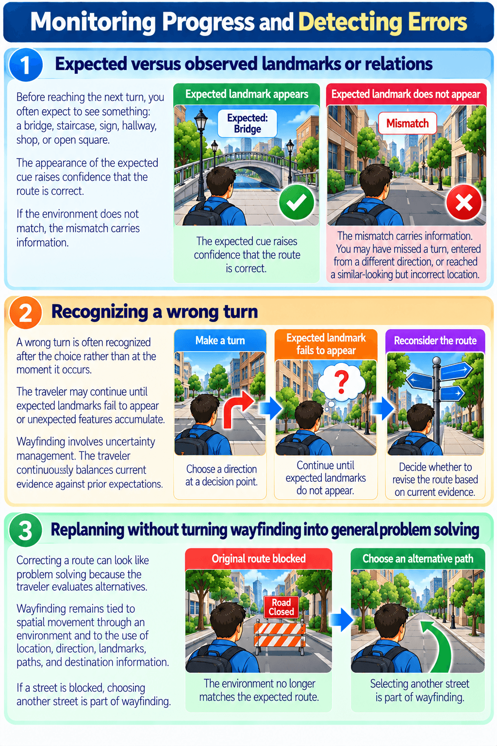
Wayfinding is partly predictive. Before reaching the next turn, you often expect to see something: a bridge, staircase, sign, hallway, shop, or open square. The appearance of the expected cue raises confidence that the route is correct.
If the environment does not match, the mismatch carries information. You may have missed a turn, entered from a different direction, misunderstood the instruction, or reached a similar-looking but incorrect location.
This monitoring process does not require a conscious checklist. In familiar environments, it may happen quickly and automatically. You simply experience a sense that “this does not look right” and begin checking what changed.
Recognizing a wrong turn
A wrong turn is often recognized after the choice rather than at the moment it occurs. The traveler may continue until expected landmarks fail to appear or unexpected features accumulate.
The practical challenge is deciding how much contradictory evidence is enough to revise the route. Turning around after one missing shop may be unnecessary if the shop has closed. Continuing despite several mismatches may take you farther away.
Wayfinding therefore involves uncertainty management. The traveler continuously balances current evidence against prior expectations.
Replanning without turning wayfinding into general problem solving
Correcting a route can look like problem solving because the traveler evaluates alternatives. The difference is scope. Wayfinding remains tied to spatial movement through an environment and to the use of location, direction, landmarks, paths, and destination information.
If a street is blocked, choosing another street is part of wayfinding. A general theory of problem solving would also cover mathematical puzzles, social dilemmas, equipment failures, and many nonspatial goals. The overlap is real, but the constructs are not interchangeable.
Familiar vs Unfamiliar Wayfinding
Route knowledge and habits in familiar spaces
Familiar journeys often rely on highly practiced sequences. You may leave home, take the same road, enter the same station, and choose the same platform with little conscious deliberation.
Route knowledge makes this efficient. Familiar landmarks appear in the expected order, and decision points are linked to habitual actions. The traveler does not need to recompute the whole environment at every step.
The weakness becomes visible when something changes. A closed entrance, roadworks, relocated bus stop, or blocked corridor can disrupt the sequence and force broader spatial knowledge back into use.
Exploration, signage, environmental cues, and uncertainty in unfamiliar spaces
Unfamiliar wayfinding relies more heavily on external information. Signs, maps, building layout, visible landmarks, staff directions, and structural cues help reduce uncertainty.
An integrative review of wayfinding in interior environments identified spatial memory, floor-plan configuration, landmarks, signs, and maps as recurring factors in indoor wayfinding research. The review also shows why environmental complexity matters: more complicated layouts can make it harder to form and use a coherent representation.
This does not mean there is one universally best sign or landmark. Usefulness depends on location, visibility, task, familiarity, and how the environment is organized.
Wayfinding vs Cognitive Maps
Representation versus use
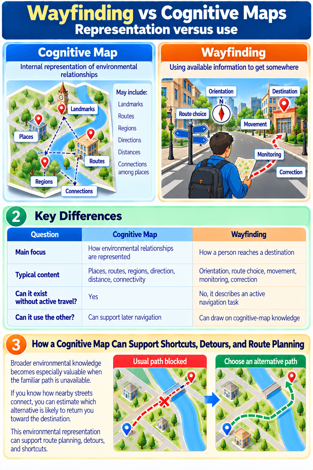
A cognitive map concerns the internal representation of environmental relationships. It may include landmarks, routes, regions, directions, distances, and connections among places.
Wayfinding concerns using available information to get somewhere. A person may draw on a cognitive map while navigating, but the two concepts answer different questions.
| Question | Cognitive Map | Wayfinding |
|---|---|---|
| Main focus | How environmental relationships are represented | How a person reaches a destination |
| Typical content | Places, routes, regions, direction, distance, connectivity | Orientation, route choice, movement, monitoring, correction |
| Can it exist without active travel? | Yes | No, it describes an active navigation task |
| Can it use the other? | Can support later navigation | Can draw on cognitive-map knowledge |
How a cognitive map can support shortcuts, detours, and route planning
Broader environmental knowledge becomes especially valuable when the familiar path is unavailable. If you know how nearby streets connect, you can estimate which alternative is likely to return you toward the destination.
A review of cognitive maps in human navigation discusses how environmental representations can support route planning, detours, and shortcuts. The important distinction is that this representation is one resource within wayfinding, not the whole activity.
A traveler may also reach a destination with very little map-like knowledge by following signs or step-by-step directions. Successful wayfinding therefore does not prove that a rich cognitive map is present.
Wayfinding vs Route Knowledge
Knowing one path versus navigating with multiple information sources
Route knowledge stores a sequence such as “left at the bank, straight to the park, right after the bridge.” Wayfinding is the use of information during the journey itself.
If every cue appears exactly as expected, route knowledge may dominate. The traveler recognizes each point and performs the associated action.
If the bank is gone, the park entrance is closed, or the traveler begins from a different street, additional information becomes necessary. Orientation, signs, landmarks, maps, or broader layout knowledge may be used to recover.
When route knowledge is enough and when flexibility requires more
For a stable, familiar trip, route knowledge can be sufficient. There is no need to represent every surrounding street if one sequence reliably reaches the goal.
Flexibility matters when conditions change. A detour, unfamiliar starting point, unexpected entrance, or missing landmark can force the traveler to move beyond the learned chain.
This is why wayfinding should not be evaluated only by whether someone remembers directions. The task includes adapting when the environment does not perfectly match the stored route.
Wayfinding vs Spatial Orientation and Path Integration
Where am I and which way am I facing?
Spatial orientation concerns the current relationship between the traveler and the surrounding environment. It answers questions about self-location and heading.
Wayfinding uses that information to decide where to go next. You can be fully oriented while sitting in a park with no destination. Once you decide to reach the north gate, orientation becomes one input to the navigation task.
How movement-based updating can contribute without defining the whole activity
Movement itself can help update where a traveler is. After walking forward, turning right, and continuing, information about distance and direction contributes to the estimate of current position.
Path integration refers specifically to this kind of self-motion updating. Wayfinding is broader because it can also use landmarks, maps, signs, route knowledge, cognitive maps, and destination information.
A person following signs through an airport is engaged in wayfinding even if movement-based updating contributes very little. A person walking in darkness and estimating how to return to a starting point may rely heavily on movement-based updating without performing a complex wayfinding task toward a named destination.
What Makes an Environment Easier or Harder to Navigate?
Legibility, distinct landmarks, decision points, and conflicting cues
Some environments make their structure easier to understand. Distinctive landmarks, clear signs, visible destinations, differentiated corridors, and understandable connections can reduce ambiguity.
Other spaces are repetitive. Identical hallways, similar intersections, hidden exits, poor signage, and complex floor plans increase the number of plausible interpretations. The traveler has fewer reliable cues for deciding whether the current path is correct.
Research on cognitive maps also shows substantial individual differences. A review titled Cognitive Maps: Some People Make Them, Some People Struggle argues against assuming that everyone forms equally accurate map-like representations from navigation experience. That variability helps explain why two people can learn the same environment differently.
Why environmental design is not the whole story
An easy-to-read environment helps, but the traveler’s knowledge and goal still matter. A clearly marked hospital can remain confusing if someone enters through an unexpected door or is looking for a department whose signs use unfamiliar terminology.
Likewise, a complicated old neighborhood may be effortless for someone who has lived there for years. Familiarity can compensate for many environmental ambiguities.
Wayfinding therefore emerges from the interaction between person, task, and environment. No single design feature guarantees success in every situation.
Common Misunderstandings About Wayfinding
No single strategy is best in every environment
A landmark-based strategy can be efficient when landmarks are distinctive. Route sequences work well when the path is stable. Broader layout knowledge becomes valuable for shortcuts and detours. Signs are useful when they are visible and relevant. Maps are useful when the traveler can relate the display to the current environment.
The best information source changes with context. Treating one strategy as universally superior ignores the flexibility that characterizes human navigation.
Wayfinding is not simply memory or attention
Memory matters because the traveler may need stored routes, landmarks, or environmental knowledge. Attention matters because relevant cues must be noticed. Neither process alone defines wayfinding.
A person can remember a route but choose the wrong starting direction. Another person can notice every sign but misunderstand how the destinations relate. Wayfinding depends on coordinating several processes around the practical goal of reaching a place.
Getting lost does not automatically imply a disorder
People can become disoriented because an environment is unfamiliar, repetitive, poorly signed, unexpectedly changed, or entered from an unusual direction. Missing a turn or feeling confused in a complex building can happen without indicating a medical problem.
Sudden, substantial, or worsening difficulty navigating familiar environments is different, especially when it occurs with confusion, speech difficulty, weakness, severe headache, altered awareness, or other neurological symptoms. In that situation, medical evaluation may be appropriate.
FAQ About Wayfinding Psychology
These questions clarify how wayfinding differs from the spatial processes that often contribute to it.
Is wayfinding the same as having a cognitive map?
No. A cognitive map is an internal representation of environmental relationships. Wayfinding is the activity of reaching a destination. A cognitive map can support wayfinding, especially for shortcuts and detours, but a person can also navigate successfully by following signs, landmarks, or step-by-step route instructions.
Can someone know a route but still get disoriented?
Yes. Route knowledge tells you what sequence to follow, but orientation tells you where you are and which direction you are facing. If you begin from an unexpected entrance or approach a familiar route from the opposite direction, the sequence may be known while your current orientation is uncertain.
Why are landmarks especially useful at decision points?
Decision points require the traveler to choose among alternatives. A distinctive landmark located at or near the correct turn can connect recognition directly with action. It can also confirm that the traveler has reached the expected location before making the next choice.
Is path integration the same as navigation?
No. Path integration refers more specifically to updating position from self-motion information such as movement and turns. Navigation and wayfinding can use that information, but they can also depend on landmarks, signs, maps, route memory, environmental representation, and destination knowledge.
Key Takeaways
- Wayfinding is the goal-directed activity of getting from a current location to a destination.
- The process involves orientation, route choice, movement, monitoring, landmark recognition, error detection, correction, and arrival.
- Landmarks are especially useful when they identify locations or mark decision points, but they are only one source of navigation information.
- Cognitive maps, route knowledge, spatial orientation, and path integration can all support wayfinding without being identical to it.
- Familiar and unfamiliar environments place different demands on the traveler because the available spatial knowledge differs.
- Successful navigation depends on an interaction between the person, the task, and the environment rather than one universally best strategy.
A useful way to think about your own navigation is to notice what happens when the expected route breaks. If you can only repeat the original sequence, your wayfinding may depend heavily on route knowledge. If you can reorient, identify useful landmarks, understand the broader layout, and choose a new path, several forms of spatial information are working together.
Educational note: This article explains ordinary wayfinding and spatial cognition. It is not a substitute for official navigation tools, road signs, trained guidance, or safety procedures in driving, hiking, wilderness travel, aviation, boating, emergency evacuation, or other situations where accurate navigation is safety-critical.
At Psychology Exposed, Michael Reed focuses on translating research about cognition and behavior into clear explanations of everyday experience.

Michael Reed is the Founder and Lead Writer at Psychology Exposed. He writes about human behavior, relationships, emotional patterns, self-awareness, and practical psychology topics using research-informed, easy-to-understand content.
Read More About Michael Reed: https://psychologyexposed.com/michael-reed/